


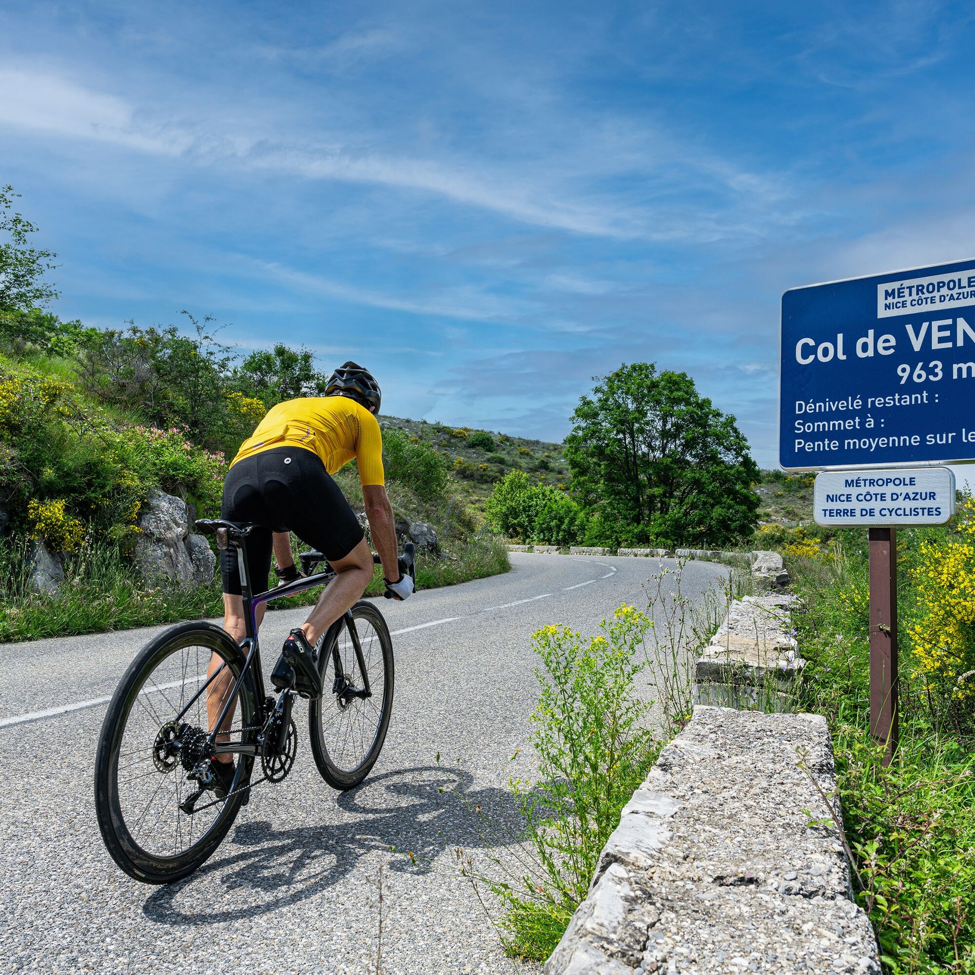
Col de Vence climb


This is a particularly difficult pass in summer. The landscape becomes desolate as you climb, and there's no shade to be found for the entire 10km. Facing due south, the temperature can easily reach 35°....
This is a particularly difficult pass in summer. The landscape becomes desolate as you climb, and there's no shade to be found for the entire 10km. Facing due south, the temperature can easily reach 35°. For this reason, the climb is recommended in the early morning.
Don't forget to fill your water bottle at the foot of the pass, at the little fountain near the start.

From the start, follow RM 2.
The first urban kilometer has steep gradients.
After the quarry, at the start of the climb, on the 3 rd kilometer, the gradient becomes steeper, with passages of over 10% for 500 m.
The remainder of the pass is steady but without any flat spots, with an average gradient of 6.5-7%.
-Wear an approved helmet
-Check the condition of your tires
-Carry a repair kit in case of a puncture
-Prefer at least one flashing LED light to be fixed to the seatpost so that you can be seen by motorists.
BASIC RULES
Choose a climb suited to your physical condition, and don't overestimate your abilities.
Before setting off, find out about mountain weather conditions and pass opening times.
Carry identification and a telephone number to call in case of danger.
Respect the environment
Control your speed on the fast descent
Bus routes can be found at: https://www.lignesdazur.com
By road
Vence is located high on the coastline.
To get there, take the A8 "La Provençale" freeway from Aix-en-Provence and the west:
N°47 Villeneuve-Loubet: Villeneuve-Loubet Centre, Vence , Cagnes-sur-Mer
From the eastern border, take the Cagnes sur Mer exit:
N°48 Cagnes at 181 km: Vence, Cagnes-sur-Mer
Then take the RM36 towards Vence
Bus routes can be found at: https://www.lignesdazur.com
Parking Marie Antoinette near the panoramic departure point - Paid surface parking - 153 spaces
All outdoor activities in the Nice Côte d&039;Azur region can be found at
Beliebte Touren in der Nähe
Die "Route des Paysages" zwischen der Küste und dem Mittelgebirge von Nizza
leichtMotorrad147,7 kmGrande Randonnée® de Pays: Lou Camin Nissart
schwerFernwanderweg44,7 kmMountainbike-Rundkurs FFC n°7 - La Ronde des Oliviers
leichtMountainbike8,09 kmGrasse - Rundtour
mittelWanderung14,4 kmCircuit VTT FFC n°1 : Le tour du Mont Chauve
mittelMountainbike11 kmAuf den Straßen der 1. Etappe des Tour De France 2020 - Große Rundtour
mittelRennrad74,2 kmFFC-Mountainbike-Rundkurs n°25 : Der Gipfel des Broc
mittelMountainbike18,9 kmCircuit VTT FFC n°50 : le Calamel
mittelMountainbike18,0 kmCircuit VTT FFC n°6 : Le collet des Sausses
mittelMountainbike7,39 kmNizza - Aspremont / Route Pagarine (Etappe 1)
mittelWanderung15,8 km
Wandern & Tracking


Verpasse keine Angebote und Inspirationen für deinen nächsten Urlaub
Deine E-Mail-Adresse wurde in den Verteiler eingetragen.