


Le Pic de Tarbésou


Access: From Ax-les-Thermes, follow the RD613 towards Quillan. After 3.5km, turn right onto the RD25 to the Col de Pailhères. After the houses and before reaching the pass, park on the left at the reception area.

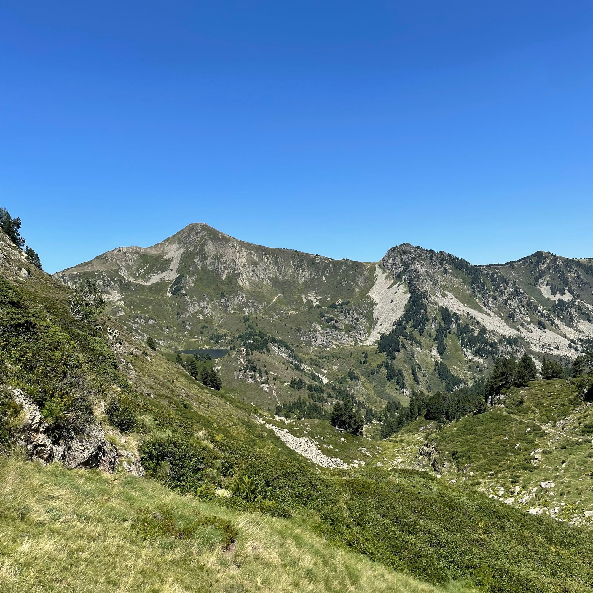
Start - Aire d'Accueil (1,950m). Cross the road and follow the signposted path and cairns up towards the ridge, at which point the GR turns south along the pastoral track. At the well-marked bend, leave the track, leaving the GR heading south, and take the path (yellow markings) just above, heading south-west. The path climbs steadily up the slope until it reaches the Mougnégou ridge, which you climb up, still south-west. The slope steepens as you approach the summit of Pic de Tarbésou.
1h40 - Pic de Tarbésou (2,364m). From the summit, descend to the south-west on the full ridge.
2h00 - Col (2,119m). Continuing due south, climb the Sarrat de Gabensa, then avoid a small picot on the western slope. Before the Roc de Bragues, descend the eastern slope to a small laquet. The GR 7B markings are again visible, and we follow them northwards.
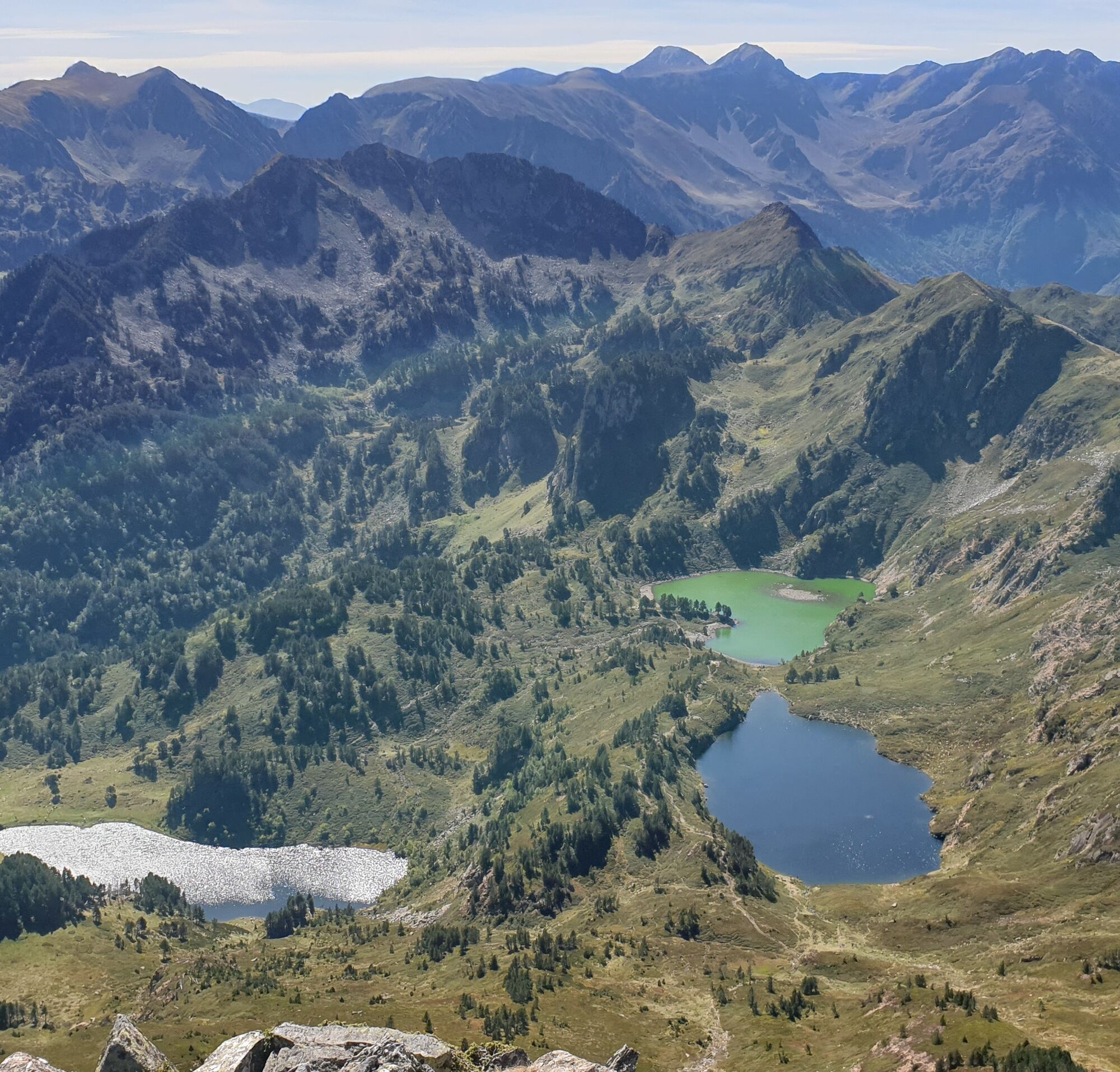
2h10 - Étang Bleu (1920m). Ignore the path that joins the Etang de Rabassoles and follow the GR 7B to the Etang Noir, which you skirt to the right. Bend northeast towards rocky bars.
4h00- Col de la Coumeille de l'Ours (2,180m). From the pass, head north to join the track abandoned on the way up.
4:50 am - Arrival at Aire d'Accueil
Ja
Beliebte Touren in der Nähe
L'Ariégeoise XXL - circuit cyclosport n°6
schwerRennrad178,5 kmL'Hospitalet-près-l'Andorre - Lac de Bouillousses
schwerBergwandern24,7 kmGR10 Pyrenäenweg Etappe 45
mittelFernwanderweg16,9 kmC 3. Etappe Artigues-Tarascon, Okzitanien/Frankreich
schwerRadfahren63,2 kmL'Ariégeoise xxl - circuit n°6
schwerRennrad176,1 kmThe Perics tour
mittelWanderung47,5 km- 4,0
Pic de Tarbesou - Carena Runde - Etang Noir et Blue
mittelWanderung12,3 km Le Pic du Tarbésou
mittelWanderung2,82 kmCircuit cyclosport 11 - Le cyclotour de l'Ariège - Etape 4 : de Prades à Ax-les-Thermes
schwerRennrad68,4 kmLa Grande Traversée VTT Ariège Pyrénées FFC Label
schwerMountainbike32,5 km
Wandern & Tracking


Verpasse keine Angebote und Inspirationen für deinen nächsten Urlaub
Deine E-Mail-Adresse wurde in den Verteiler eingetragen.